


Thursday Weather Blog
It's the final day of spring. Summer starts tomorrow. Right on cue, Mother Nature is tossing us some summer-like weather.
Stream Connecticut News for free, 24/7, wherever you are.


The combination of high relative humidity levels, along with very warm temperatures, will make today feel as hot as 88 to 98 degrees across many towns. It will feel hottest in the Connecticut River Valley and coolest along the southeast shoreline.
Get top local Connecticut stories delivered to you every morning with the News Headlines newsletter.

Stay cool by trying to stay shaded and hydrated today. Wear light-colored and loose-fitting clothing and avoid strenuous activity during the hottest part of the day, usually during midday and afternoon.


The heat and humidity will also result in quite a bit of instability in the atmosphere which will promote the development of scattered strong to severe thunderstorms in the afternoon and evening.
A level 2 out of 5 risk for severe weather is forecast across most of Connecticut. The main threats from any thunderstorm include lightning, heavy rain, strong wind and large hail.

Friday and Saturday look relatively pleasant with sunshine and temperatures in the 80s. By early next week, however, a major heat wave is expected to develop with temperatures approaching 100 degrees and the heat index approaching 105!
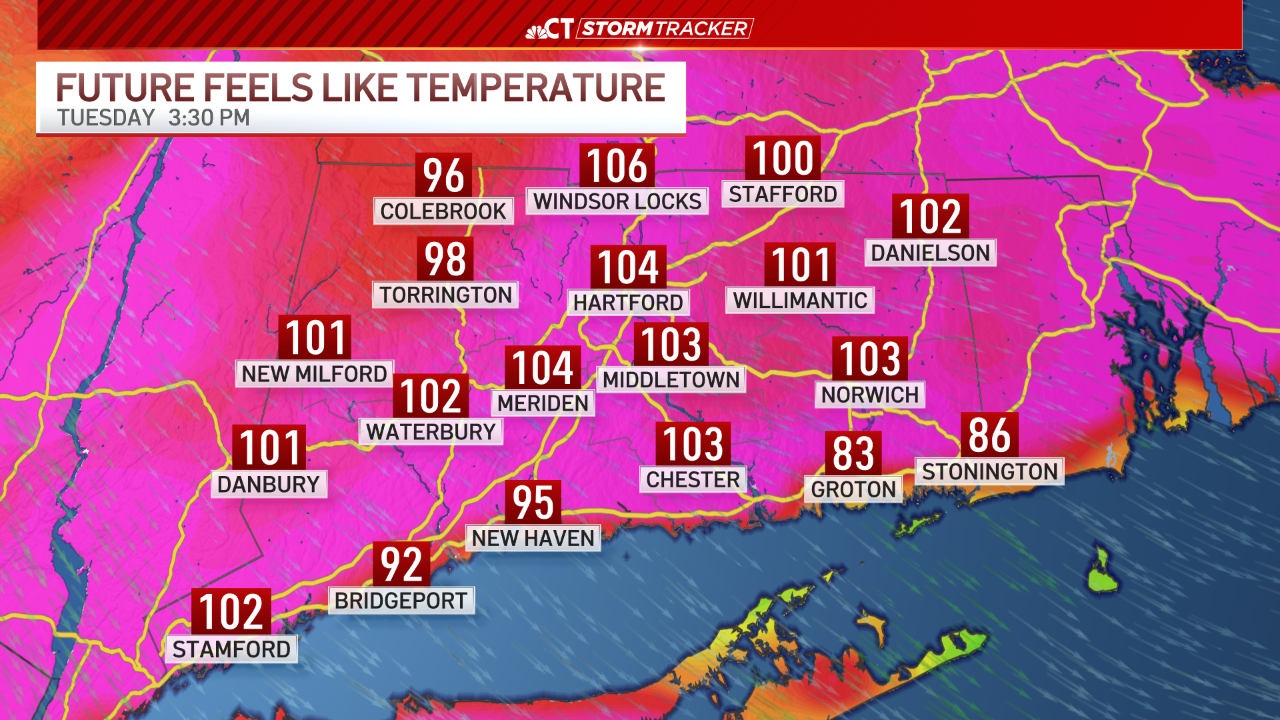
The worst of the heat is expected to reach Connecticut on Tuesday.
Local


Stay cool over the coming days!

