


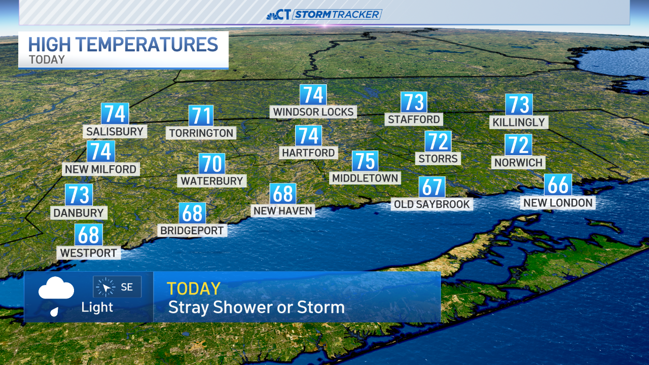
Thursday Weather Blog
We will see a lot of clouds today with a few showers and even a downpour in a few towns. It's far from a washout today and we may see some sunny breaks this afternoon. The muggy airmass is in place and will stick around into Saturday afternoon.
Stream Connecticut News for free, 24/7, wherever you are.


Showers, low clouds and widespread fog looks likely tonight with mild lows in the lower 60s.
Get top local Connecticut stories delivered to you every morning with the News Headlines newsletter.


Saturday is interesting with a cold front and possibly a pre-frontal trough producing scattered morning and midday thunderstorms. This is part of the process to clear us out for Sunday....lower humidity will arrive by later weekend and early next week.

On and off showers and storms are possible through Friday, as well. However, the best chance for rain comes on Saturday. Thunderstorms are likely with the final push of this rain system before we dry out into Sunday.


Winds will increase as temperatures decrease into early next week. Looking ahead, data favors a cool down through Memorial Day Weekend. Stay tuned!


